
Modern travel demands smarter solutions. Real-time route adjustment technology transforms how we navigate, reducing travel time and eliminating unnecessary stress from daily commutes and long journeys alike.
🚗 The Revolution in Modern Navigation
Gone are the days when travelers relied solely on printed maps or static GPS directions. Today’s navigation landscape has evolved dramatically, offering dynamic solutions that adapt to changing road conditions in real-time. This technological leap represents more than convenience—it’s a fundamental shift in how we approach travel planning and execution.
Real-time route adjustment leverages sophisticated algorithms, live traffic data, and crowd-sourced information to continuously evaluate your journey. Unlike traditional navigation systems that calculate a route once and stick with it, modern platforms reassess conditions every few minutes, sometimes even seconds, to ensure you’re always taking the most efficient path available.
The impact extends beyond individual travelers. Cities worldwide are experiencing reduced congestion, lower emissions, and improved traffic flow as more drivers adopt intelligent navigation systems. This collective benefit demonstrates how personal technology choices can contribute to broader societal improvements.
🧠 How Real-Time Route Adjustment Actually Works
Understanding the technology behind real-time navigation helps appreciate its remarkable capabilities. At its core, the system combines multiple data sources into a comprehensive picture of current road conditions.
GPS satellites provide your precise location, while cellular networks transmit data about traffic speeds from millions of users simultaneously traveling on the same roads. This anonymized data creates a living map of traffic flow, identifying slowdowns before you encounter them.
Advanced algorithms process this information alongside historical traffic patterns, weather conditions, road closures, accidents, and special events. Machine learning models predict how conditions will evolve during your journey, not just reflecting current circumstances but anticipating future changes.
The Data Sources That Power Smart Navigation
Multiple information streams work together to create accurate routing recommendations:
- Crowd-sourced traffic data: Anonymous speed and location information from millions of drivers
- Official traffic reports: Data from transportation departments and traffic management centers
- User-reported incidents: Real-time alerts about accidents, hazards, and road conditions
- Historical patterns: Years of accumulated data revealing typical traffic flows
- Weather integration: Current and forecasted conditions affecting driving
- Event calendars: Concerts, sports games, and public gatherings impacting traffic
⏱️ Measurable Benefits: Time and Money Saved
The practical advantages of real-time route adjustment extend far beyond abstract improvements. Studies consistently demonstrate tangible benefits that directly impact travelers’ lives and wallets.
Research indicates that drivers using advanced navigation with real-time updates save an average of 15-20% on travel time compared to those using static routes. For someone with a 30-minute commute, this translates to 6-9 minutes saved daily—adding up to approximately 40 hours annually that could be redirected to productive or enjoyable activities.
Fuel savings represent another significant advantage. By avoiding stop-and-go traffic and finding more efficient routes, drivers typically reduce fuel consumption by 10-15%. With fuel prices remaining volatile, these savings accumulate substantially over time, potentially hundreds of dollars per year for regular commuters.
The Stress Reduction Factor
Beyond measurable metrics, the psychological benefits prove equally valuable. Traffic congestion ranks among the top daily stressors for commuters worldwide, contributing to elevated blood pressure, anxiety, and reduced overall well-being.
Real-time navigation reduces this stress through predictability and control. Knowing you’re on the optimal route, receiving advance warning of delays, and having alternative options readily available creates a sense of agency that traditional navigation cannot provide.
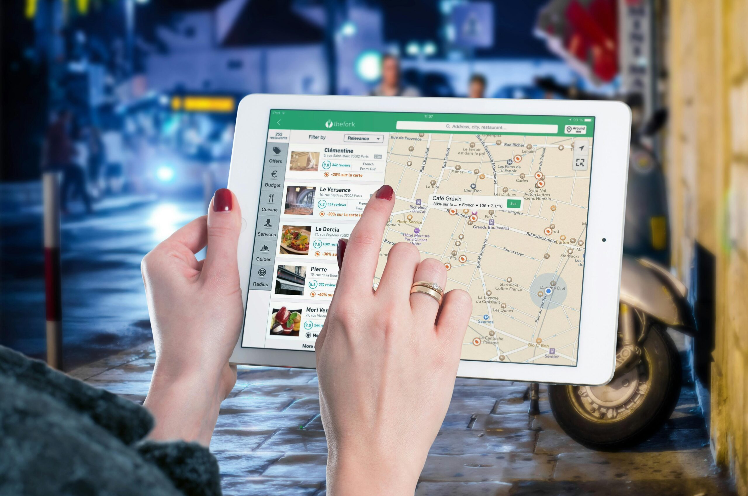
🗺️ Popular Navigation Platforms Leading the Way
Several navigation applications have distinguished themselves through superior real-time adjustment capabilities, each offering unique features suited to different user preferences.
Google Maps remains the most widely used navigation platform globally, benefiting from extensive data collection and integration with other Google services. Its real-time traffic updates draw from billions of location data points, creating highly accurate traffic predictions. The platform excels at integrating public transportation options, walking directions, and business information into comprehensive journey planning.
Waze has built its reputation on community-driven reporting, where users actively share information about accidents, police presence, road hazards, and traffic conditions. This social approach creates an engaged user community and often provides the fastest alerts for sudden incidents. The platform’s algorithm aggressively reroutes drivers to minimize travel time, sometimes suggesting unconventional routes that prove surprisingly efficient.
Apple Maps has significantly improved its real-time capabilities in recent years, offering seamless integration for iPhone users and privacy-focused features that appeal to security-conscious travelers. The platform provides detailed lane guidance and junction views that help drivers navigate complex intersections with confidence.
🎯 Maximizing Your Navigation System’s Potential
Simply having a navigation app installed doesn’t guarantee optimal results. Strategic use of these tools amplifies their benefits considerably.
Always input your destination before beginning any journey, even for familiar routes. This allows the system to monitor conditions along your entire path and alert you to problems you wouldn’t otherwise anticipate. Traffic patterns change daily, and the route that worked yesterday might be congested today.
Enable notifications and audio alerts to receive updates without constantly checking your phone. Modern navigation systems can notify you when significantly faster routes become available or when conditions change ahead, allowing you to adjust while maintaining focus on driving safely.
Timing Your Departures Strategically
Most navigation platforms offer departure time recommendations showing when traffic will be lightest. Checking this information when planning your day can reveal opportunities to avoid peak congestion by leaving just 15-30 minutes earlier or later.
For recurring trips, analyze patterns over several weeks. You might discover that Tuesday mornings consistently offer better conditions than Wednesdays, or that leaving at 7:45 AM rather than 8:00 AM reliably saves 10 minutes. These insights enable proactive schedule adjustments that compound time savings.
🌐 Real-Time Adjustment Beyond Daily Commutes
While commuter benefits receive significant attention, real-time navigation proves equally valuable for less frequent travel scenarios.
Road trips gain new flexibility when you can adapt routes based on developing weather conditions, unexpected attractions, or changing interests. If storm systems approach your planned path, real-time systems can suggest alternative routes that maintain your timeline while avoiding dangerous conditions.
Urban exploration becomes more efficient when navigating unfamiliar cities. Real-time systems help you discover parking options, avoid tourist congestion, and find the quickest paths between attractions, maximizing your limited time in new locations.
Commercial and Professional Applications
Delivery drivers, sales professionals, and service technicians who make multiple stops daily find exceptional value in route optimization. Advanced navigation platforms can sequence stops for maximum efficiency, accounting for time windows, traffic patterns, and distance to minimize total travel time and fuel consumption.
Emergency responders rely on real-time routing to reach incidents as quickly as possible, where seconds can determine outcomes. The technology provides crucial advantages by identifying the fastest current path rather than the theoretically shortest distance.
🔒 Privacy Considerations in Connected Navigation
The same data collection that enables powerful real-time features raises legitimate privacy questions. Understanding how navigation platforms handle your information helps make informed choices about which services to use and how to configure them.
Most major navigation platforms collect anonymized location data to power their traffic analysis. This data typically cannot be traced back to individual users, existing instead as aggregate speed measurements on specific road segments. However, your personal search history, saved locations, and routing patterns may be stored in identifiable forms.
Review your navigation app’s privacy settings regularly. Most platforms offer options to limit data collection, delete location history, or prevent personalized advertising based on your travels. Balancing privacy preferences with functionality requires understanding these trade-offs—stricter privacy settings may reduce the accuracy of personalized recommendations.
📱 Integration with Connected Vehicle Systems
Modern vehicles increasingly feature built-in navigation systems that connect to smartphone apps, creating seamless experiences across devices. This integration enhances real-time adjustment capabilities through additional vehicle sensors and displays.
Connected car systems can share information about fuel levels, vehicle diagnostics, and driving patterns with navigation apps, enabling recommendations for charging stations, maintenance facilities, or fuel stops along your route. These integrated suggestions consider your specific vehicle’s needs rather than generic recommendations.
Dashboard displays provide safer access to navigation information than phone screens, with larger text, better contrast, and positioning within your natural sight line. Voice control through vehicle systems often proves more reliable than phone-based assistants, particularly in noisy environments.
🌟 Future Developments in Intelligent Navigation
The trajectory of navigation technology suggests even more powerful capabilities emerging in coming years, fundamentally changing how we approach travel.
Artificial intelligence advances will enable predictive routing that learns your preferences, typical destinations, and travel patterns. Your navigation system might automatically suggest leaving early for an important meeting based on unusual traffic patterns it detects, or recommend alternative times for flexible appointments to avoid congestion you haven’t even encountered yet.
Vehicle-to-vehicle communication will create peer-to-peer traffic networks where cars share real-time information directly, reducing dependence on centralized data processing. This distributed approach could provide even faster updates about sudden hazards or changing conditions.
Autonomous Vehicle Integration
As autonomous vehicles become more prevalent, real-time navigation will transition from driver assistance to vehicle command systems. Self-driving cars will continuously negotiate optimal routes not just for individual vehicles but for entire fleets, potentially coordinating with other autonomous vehicles to minimize overall congestion.
This evolution will blur the line between personal navigation and traffic management, creating transportation networks that function more like living organisms than static infrastructure.
💡 Practical Tips for Immediate Implementation
Implementing these strategies today can immediately improve your travel experiences without waiting for future innovations.
Update your navigation apps regularly to ensure access to the latest features and traffic data algorithms. Developers continuously refine routing logic based on performance data, meaning yesterday’s version may produce noticeably different results than today’s.
Contribute to community-based navigation platforms by reporting incidents you observe. This collective participation improves data quality for everyone, creating better routing recommendations across the entire user community. Most apps make reporting quick and simple, requiring just a few taps while stopped safely.
Experiment with different navigation platforms for the same routes to identify which performs best for your specific needs. Geographic variations, data partnerships, and algorithmic differences mean one platform might consistently outperform others in your particular area or for your travel patterns.
🚀 Embracing the Smart Navigation Mindset
Maximizing real-time route adjustment benefits requires more than technology—it demands a mental shift toward flexible, adaptive travel planning. The rigid “this is my route” mentality that served previous generations poorly suits modern traffic dynamics.
View your navigation system as a collaborative partner rather than a simple tool. Trust its recommendations even when they seem counterintuitive, recognizing that the system processes far more information than any individual driver can observe directly. Over time, this trust typically proves justified through consistently better outcomes.
Remain open to unconventional routes. The fastest path often involves roads you wouldn’t normally consider, whether residential streets that avoid congested arteries or seemingly longer routes that maintain higher speeds. Real-time systems excel at identifying these non-obvious efficiencies.
The transformation in navigation technology represents one of the most practical applications of big data and artificial intelligence in everyday life. By harnessing real-time route adjustment capabilities, travelers gain measurable advantages in time savings, reduced stress, and improved reliability. Whether commuting daily or exploring new destinations, smart navigation turns uncertainty into predictability and transforms travel from a potential frustration into a optimized experience. The technology continues evolving rapidly, promising even greater capabilities ahead, but the tools available today already provide substantial benefits for those who use them strategically.